-
 ×
× - Domů
- Umělecké Tisky ▸
- Umělci ▸
- Kategorie ▸
- Výtvarné Styly ▸
- Obrazový rám ▸
- Tiskové médium ▸
- Všechna tisková média
- Plátno Leonardo (satén)
- Plátno Salvador (matné)
- Plátno Raphael (matné)
- Matný umělecký fotopapír
- Saténový umělecký fotopapír
- Barytový umělecký fotopapír
- Lesklý umělecký fotopapír
- Akvarel lepenka Munch
- Akvarel lepenka Renoir
- Akvarel lepenka Turner
- Akvarel lepenka Dürer
- Natural Line Hemp
- Natural Line Rice
- Kozo White, 110g
- Kozo Natural, 110g
- Inbe White, 125g
- Unryu, 55g
- Bamboo, 110g
- Premio Unryu, 165g
- Murakumo Natural, 42g
- Bizan Natural, 300g
- Bizan White, 300g
- Hliníkový kompozit 3mm
- Akrylátové sklo 5mm
- Objednat sadu vzorků
- Které tiskové médium se hodí?
Plátno
Fotopapír
Akvarelový karton
Natural Line
Japonský papír
Speciální média
Další informace
- Pomoc a servis ▸
- Kontaktujte nás
- Prodejte své umění
- Často kladené otázky
- Volná místa
- Reklamace
- Objednat vzorky
- Objednat poukázky
- Náklady na dopravu
- Doba výroby
- Udržitelnost
- Vyhledávání obrázků
- Zvláštní požadavky
- Kdo jsme?
- Cenová politika
- Firemní politika
- Záruka kvality
- Ocenění
- Napínací rám
- Pasparty
- Dekorativní rámy
- Zasklení
- Lišty
- Závěsné systémy
- Tisková média
- Tipy na údržbu
- Tisk
- Obchodní podmínky
- Ochrana údajů
- Právo na zrušení
Informace a služby
Další informace
Důležité informace
Právní informace
- Obchod ▸
- Kontakt





 Zobrazit ve 3D / AR
 Přidat do oblíbených
 Zvolte barvu stěny
 Zobrazit obraz v místnosti
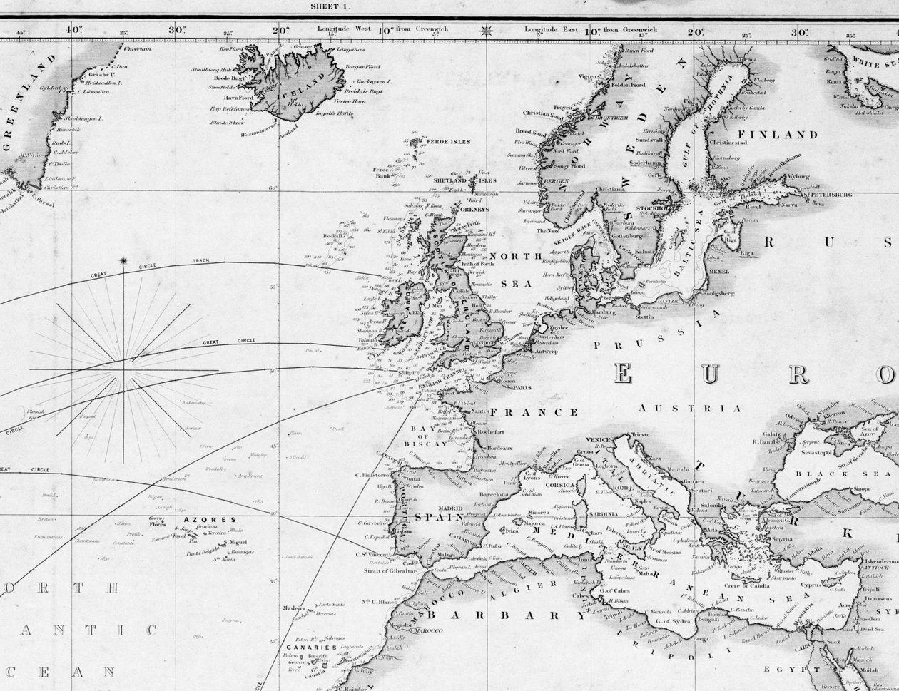
.jpg "Mapa severního Atlantského oceánu se Severním mořem")
.jpg "Obecná mapa pro účely vytyčení dráhy lodi.")
.jpg "Mapa Západní Indie, Floridy a Jižní Ameriky")
.jpg "Atlas 131 H f.1 Mapa Bas Poitou, Pays d")
.jpg "Mapa severního Atlantiku podle Mount and Page")
.jpg "Mapa Severní Ameriky, 1747")
.jpg "Nový čínský atlas, čínský Tartary a Thibet, Haag 1737.")
.jpg "Sir John Narbroughs Voyage, c1670, 1903.")
 published Geneva 1780 - (MeisterDrucke-43614).jpg "Evropa, z „Atlasu všech známých částí zemského světa“ od Guillauma Raynala (1713-96), vydaný v Ženevě, 1780")
.jpg "Mapa pobřeží Tonquinu a Cochinchiny")
.jpg "Oceán s pobřežím Francie, Španělska, Portugalska, Anglie, Nizozemska, Dánska - podle A")
.jpg "Obecná mapa Středozemního moře zahrnující Benátský záliv, Souostroví a část Černého moře s trasami parníků")
.jpg "Mapa Atlantiku nebo Západního oceánu, ukazující dráhu Nelsonovy flotily, 12. května – 15. srpna 1805, 1807")
.jpg "Nová a přesná mapa Středozemního moře z nejnovějších průzkumů, zjištěná a upravená na základě astronomických pozorování.")
.jpg "Mapa Lamanšského průlivu a atlantického pobřeží jižní Británie a severní Francie")
.jpg "Mapa Evropy. Druhá polovina 19. století. Italský atlas. Stabilimento Civelli. Milán.")
.jpg "Generální mapa Atlantského oceánu severně od rovníku")
.jpg "Generální mapa zobrazující objevy, které učinil kapitán James Cook během této a dvou předchozích plaveb, s vyznačením tras lodí pod jeho velením. Poručík Roberts z námořnictva Jeho Veličenstva")
.jpg "Mapa světa zobrazující stopy kapitána Cooka")
.jpg "Nový a správný velký průtah Channellem mezi Anglií a Francií s pobřežím Irska St. Georges Bristoll Channell a několika nejpozoruhodnějšími přístavy na velkém prostoru.")
.jpg "Část jižního pobřeží Newfoundlandu včetně zátoky Fortune Bay")
.jpg "Úplná mapa Západní Indie s pobřežím Floridy, Louisiany, Nového Španělska a Terra Firmy: se všemi ostrovy.")
_og_vi_-_(MeisterDrucke-1072814).jpg "Mapa z mapové sbírky Národní knihovny. Mapa byla vydána v letech 1690-1708 a zobrazuje Evropu")
_-_(MeisterDrucke-1555329).jpg "Složený atlas světa, William Faden (14383015)")
 published Geneva 1780 - (MeisterDrucke-65565).jpg "Mapa světa v Mercatorově projekci, z díla „Atlas de Toutes les Parties Connues du Globe Terrestre“ od Guillaumea Raynala (1713-96), vydáno v Ženevě, 1780")
.jpg "Mapa římské Británie s Irskem a přilehlými ostrovy, mapa původně publikovaná v Londýně, 1818")
.jpg "Magnetická mapa Země")
.jpg "Průtah pobřežím Nového Holandska a přilehlými částmi")
.jpg "Hudsonův záliv, země Labrador a Grónsko s přilehlými ostrovy, rytina G. Zuliani převzatá z Toma I. z „Nejnovějšího atlasu“ vydaného v Benátkách v roce 1778 Antoniem Zattou, Soukromá sbírka")
.jpg "Irsko - západní pobřeží, přístav Glengariff. Prozkoumáno kvalifikační třídou, Navigační škola, září - říjen 1912.")
.jpg "Sibiřská modrá červenka, velmi Larvivora")
_c1720_(oil_on_canvas)_-_(MeisterDrucke-1516227).jpg "Paní Edmund Nelson (1698-1789), asi 1720 (olej na plátně)")
_-_(MeisterDrucke-1410765).jpg "Portrét gentlemana (olej na plátně)")
_-_(MeisterDrucke-1516203).jpg "Královská jachta s flotilou na cestě ve větru, asi 1720 (olej na plátně)")
.jpg "Althea Cartwright")
.jpg "Plán města New York od Ratzera")
_in_1742_-_in_Harpers_Young_People_-_(MeisterDrucke-1415993).jpg "Royal Escort (George II) v roce 1742 - v „“Harper")
.jpg "Portrét anglického krále Jindřicha IV. držícího královské žezlo, konec 16. - začátek 17. století")
.jpg "Průmyslová revoluce: pohled na železniční viadukt přes údolí Sankey. Deska převzata z \"\" Liverpool & Manchester Railway \", Londýn 1832.")
.jpg "Průmyslová revoluce: vnitřní pohled na pavilon zemědělských strojů v Crystal Palace, postavený Josephem Paxtonem pro Světovou výstavu 1851 v Londýně (Hyde Park) 19. století")
.jpg "Design pro estetický interiér, z „Dekorace interiéru Designed by McCulloch & Gow“, vydané v 80. letech 19. století (barevné lito)")
_-_(MeisterDrucke-1082889).jpg "Kapitán James Cook přistává v Austrálii (barevné lito)")
.jpg "Fergusonova křesadlová puška nabíjená zezadu, kolem roku 1780")
.jpg "Misijní loď")
.jpg "Růžový broskvoň, 1888")
.jpg "Ráno")
.jpg "Studie pláže")
.jpg "Poutník nad mořem mlhy")
.jpg "Reklamní plakát na „Maurin Quina“, Le Puy, Francie")
.jpg "Na palubě plachetnice")
.jpg "Přátelé z dětství")
.jpg "Plakal nad ní")
.jpg "Tygr v tropické bouři")
.jpg "Faustovo vidění")
.jpg "Umění malby")
_-_(MeisterDrucke-684885).jpg "Noční Berlín (Nollendorfplatz)")
.jpg "Podzimní krajina se čtyřmi stromy")
.jpg "Polibek, 1907-08")
.jpg "Modrý obraz, 1924")

 +43 4257 29415
 support@meisterdrucke.com
 Mo-Do: 7:00 - 16:00 | Fr: 7:00 - 13:00